
Largest Observation Network Empowers Agriculture
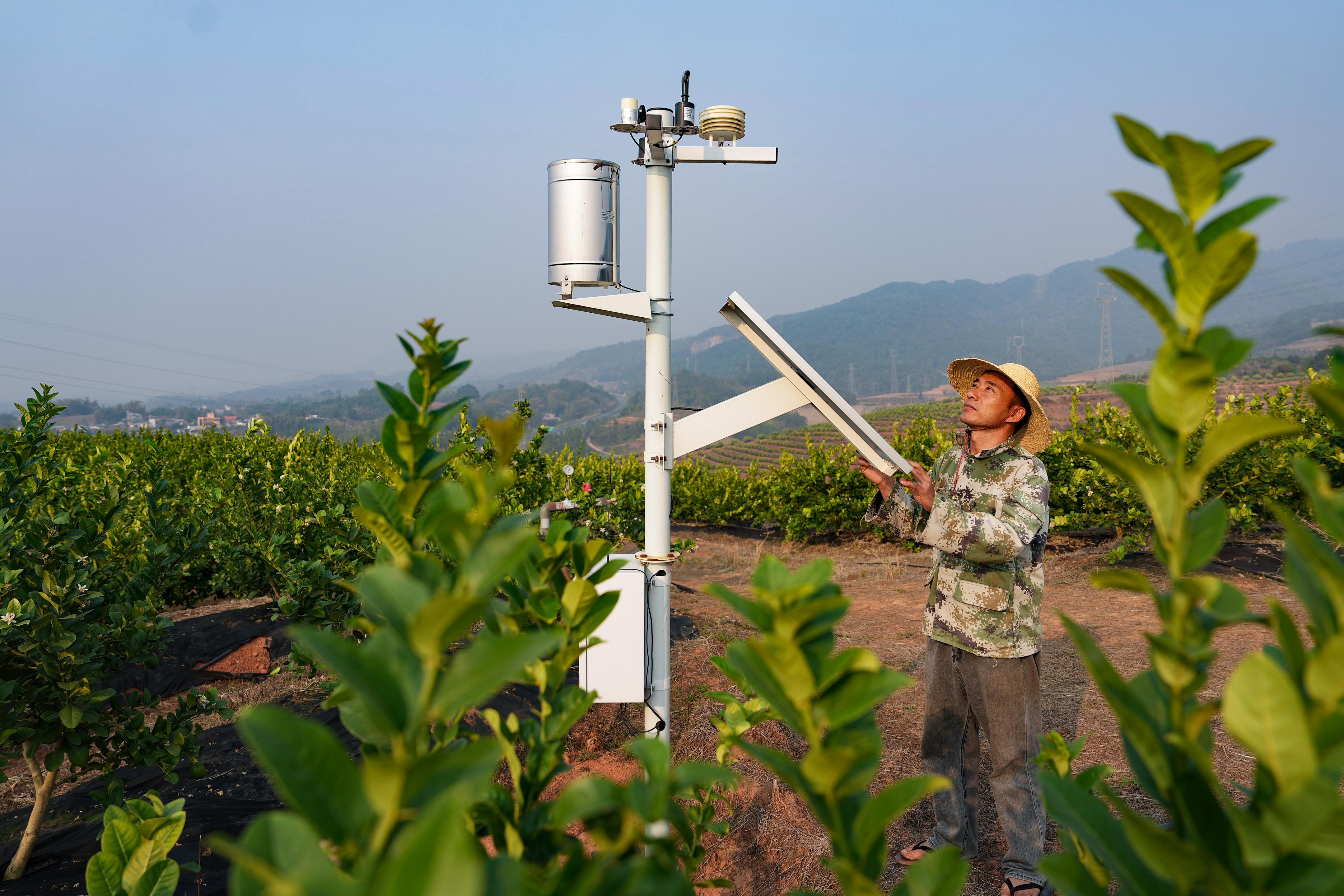
China has built the world's largest agrometeorological observation network, according to the China Meteorological Administration (CMA). Latest data from the CMA shows that the meteorological authorities have established a modern agrometeorological observation system, comprising 642 manual observation stations, 738 automatic observation stations, 15 specialized service centers and 91 experimental stations.
Under this system, manual and automatic observation complement each other, and observation and experimentation are conducted in a coordinated manner. This structure strengthens the weak links in operations in core agricultural areas and extends the vision several hundred kilometers in the sky through remote sensing satellite monitoring.
In major crop production areas like Henan province in central China, products can be monitored with a resolution ratio of 10 meters with the help of 48 sets of phenological observation systems and data from the Fengyun satellites and unmanned aerial vehicles (UAVs).
The most salient feature of this observation network is the combination of intelligence and accuracy, Wu Dongli, deputy head of the system division of the CMA Meteorological Observation Center, said.
Empowered by cutting-edge technologies like AI, laser and hyperspectral technology, China has become the only country to possess a complete set of automated observational data on crop growth stages, with the accuracy of core data exceeding 90 percent.
The intelligence of the observation network is transforming into a productive force against natural disasters.
In pest and disease control, the meteorological authorities have developed innovative monitoring and identification technologies for insects and birds based on multi-band radars. These can precisely detect and follow the trajectory of migratory pests, providing accurate decision-making support for agricultural authorities.
In terms of crop monitoring, researchers can quantitatively monitor the chlorophyll content and physiological changes of crops through the integration of hyperspectral and multi-modal data. This has enabled a change from relying on the weather for a good harvest to taking proactive action by knowing how the weather works.
This year's spring planting and efforts to increase crop yields per unit area vividly demonstrated the effectiveness of the observation network.
In China's major rice-producing regions in the south, the newly built high-standard field meteorological observation stations in Hunan province play an effective role as sentinels.
They monitor the temperature and humidity in the seedling sheds in real time and automatically issue alerts for risks like heat damage so that farmers can ventilate the sheds in time.
The observation data is not only used for warnings, but also for regulating agricultural production standards. With the growing use of UAVs for spraying pesticides, the meteorological authorities took the lead in formulating industrial standards for meteorological classification for such operations.
In Jiangsu province in the east China, a smart agrometeorological service system provides real-time forecasts about the suitability levels for aerial crop protection operations. This assists large-scale growers in precisely planning their operational windows, thereby not only shortening the pest and disease control cycle by 30 percent, but also generating substantial annual savings on pesticide costs.
Experts say that from the data transmitted via the Fengyun meteorological satellite network to minute-level disaster alerts delivered directly to the fields, a chain of precise data is enabling this agrometeorological observation network to embed cloud-based technologies deep into farmland — providing robust meteorological support for safeguarding China's food security.